Racetrack valley is a rough graded road which departs the Ubehebe Crater site and heads south into the desert. The road is rough, but easily passable in a regular car. However, when entering back country areas such as this it is always a good idea to have the insurance of a reliable vehicle, high clearance, four wheel drive, etc… Do yourself a huge favor and air down your tires if you are properly equipped to air up when the trip is over.

The racetrack valley road is a 25 miles one way trip to the playa. The road is grated, but can be heavily wash-boarded depending on the time of year, rain fall, etc…
Along the way, there are many side trips and alternate trails to help expand your visit.
As you leave Ubehebe Crater, you will be driving south and gradually gaining elevation. Take your time and enjoy the drive, if you are lucky you may see a big horn sheep herd. The road gradually gains in elevation and climbs through a Joshua Tree Forest.
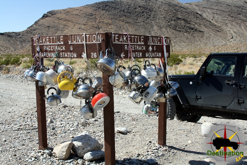
Once you reach the pass, the road continues to drop in elevation all the way down to the playa. Continue straight through tea kettle junction, and bear left down the valley past the side road to the Lippincott mine, which is a great side trail.

As you continue past the road to the Lippincott mine the road drops down to the Racetrack Playa itself. The first stop is ‘The Grandstand’ which is an outcropping of rock located in the north west corner of the racetrack. The second stop is the parking area to hike towards the stones. Don’t try to hike to the stones from the first Grandstand parking lot, or you will be hiking significantly further.
The highlight of the trip, is a short hike to the sailing or racing stones. The start of the hike is the parking area at the southern end of the racetrack playa.
To reach the stones hike east from the parking lot across the playa towards the dark stone hillside. It is short FLAT, meaning really FLAT hike towards the stones. Be sure the check the temperatures before you leave, and bring lots of water. This is true with anything you might want to do in Death Valley. Don’t walk on the playa if it is wet or muddy.

At the end of the 30 miles road there is a small primitive campground for overnight visits. Be sure to check with the National Park Service for regulations of back country camping within the park.

Notoriety
On September 19th, 1969 a Michigan front end loading is found burning along the road near the playa. Apparently, Manson order the machine burned. Park Rangers were deployed to the Racetrack. The rangers followed a set of tire tracked which belonged to a Toyota Land Cruiser which was stolen by Manson. The follow up investigate lead to the arrest of Charles Manson at Barker Ranch on October 12th, 1969.