![The Battle of Wingate pass as reports by Los Angeles herald (Los Angeles [Calif.]), March 21, 1906](https://i0.wp.com/www.destination4x4.com/wp-content/uploads/2025/08/WinGatePass.png?resize=800%2C606&ssl=1)
The so-called “Battle” of Wingate Pass, which occurred on February 26, 1906, in the rugged terrain of Death Valley, California, was not a genuine conflict but a staged hoax orchestrated by the infamous con artist Walter Edward Perry Scott, better known as “Death Valley Scotty.” This incident stemmed from Scotty’s elaborate schemes to defraud investors by promoting nonexistent gold mines in the desert. What followed the event was a chaotic sequence of retreats, media scrutiny, arrests, lawsuits, and jurisdictional disputes that exposed the fraud and led to short-lived legal repercussions. Below is a detailed chronological account of the events leading up to the “battle,” the incident itself, and the immediate aftermath, with a focus on the court actions that unfolded in the weeks and months following.
Background on Death Valley Scotty

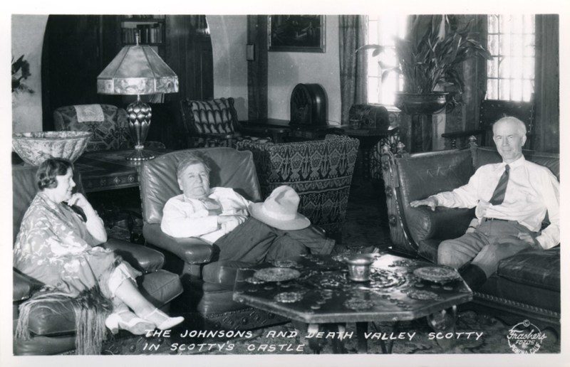
Walter Edward Perry Scott (1872–1954), famously dubbed “Death Valley Scotty,” was born in Cynthiana, Kentucky, and rose to prominence as one of the American West’s most colorful con artists. Scotty began his career as a performer in Buffalo Bill’s Wild West Show in the 1890s, where he honed his skills in showmanship and tall tales. By the early 1900s, he had relocated to California and began promoting himself as a wealthy gold prospector with secret mines in Death Valley, often flashing rolls of cash (later revealed to be “upholstered” with newspaper) to lure investors. His schemes involved “grubstakers”—investors who funded his expeditions in exchange for shares in supposed riches. Scotty’s charisma and exaggerated stories attracted figures like Chicago businessmen Albert M. Johnson and Edward A. Shedd, who invested $2,500 for a two-thirds stake in his fictional mine. However, as investors demanded proof, Scotty’s deceptions escalated, leading to elaborate hoaxes to maintain the illusion. His persona became synonymous with Death Valley, and he later lived at the opulent Scotty’s Castle (built by Johnson), perpetuating myths of hidden wealth until his death.
Events Leading Up to the “Battle”

By early 1906, Scotty’s investors were growing suspicious. New England mining promoter A.Y. Pearl had introduced Scotty to Eastern bankers and businessmen eager to inspect his claimed gold properties in Death Valley. They insisted on an evaluation by Daniel E. Owen, a reputable Boston mining engineer based in Nevada. Fearing exposure—since Scotty had no real mine—he persuaded his associate Bill Keys (a prospector and half-Cherokee Indian) to allow the group to view Keys’ modest Desert Hound Mine as a stand-in. Still anxious that Owen would deem it unworthy, Scotty hatched a plan for a staged ambush to make the area seem too dangerous for further exploration.
On February 23, 1906, the party departed from Daggett, California, equipped with two wagons, mules, horses, provisions, and whiskey. The group included Scotty, Owen, Pearl, Albert M. Johnson (president of the National Life Insurance Company of Chicago), Scotty’s brothers Bill and Warner Scott, Bill Keys, A.W. DeLyle St. Clair (a Los Angeles miner), and Jack Brody (a local desert character). Keys and Brody were sent ahead to prepare the ambush, possibly with help from an Indian named Bob Belt. The party camped at Granite Wells on February 24 and proceeded toward Lone Willow Spring the next day, leaving Bill Scott behind to guard extra animals.
Description of the “Battle”
The hoax unfolded on February 25, 1906, as the group approached Wingate Pass near Dry Lake. Shots rang out from behind stone breastworks (five of which still exist today as historical remnants), simulating an attack by claim jumpers or bandits. An ex-deputy sheriff from Goldfield, Nevada, reported being ambushed earlier, causing his pack train to stampede, adding to the chaos. Scotty fired two warning shots, startling the mules and tipping Owen from his wagon. Then, a rifle shot from the hidden assailants struck Warner Scott in the groin, an accidental injury likely due to the ambushers’ drunkenness (possibly Bob Belt). Scotty galloped toward the “attackers,” yelling for them to stop, which inadvertently exposed the ruse to the suspicious Owen.
The “battle” was brief and one-sided, with no return fire from the party. Panic ensued, and the group retreated hastily to Daggett, abandoning provisions in the desert. Warner was rushed to Los Angeles for medical treatment, where he survived after surgery. The staged nature became evident through Scotty’s over-the-top reaction and the lack of pursuit by the “ambushers.” The event involved real bullets, turning a planned scare tactic into a near-tragedy due to poor execution.
Immediate Events Following the “Battle” (Late February to March 1906)
The group’s return to civilization sparked immediate chaos. Los Angeles newspapers sensationalized the story, with Pearl initially claiming it was a genuine fight against four outlaws who were “claim jumpers” guarding Scotty’s mine. However, Owen, suspecting foul play, reported the true details to the San Bernardino County sheriff and the press, asserting that Scotty had orchestrated the ambush in an attempt to kill him and cover up the fraud. This led to a public unraveling of the hoax, as investors like Johnson realized they had been duped—though Johnson would later reconcile with Scotty and fund the construction of Scotty’s Castle in Death Valley.
The sheriff’s investigation uncovered incriminating evidence: abandoned provisions at Scotty’s “Camp Holdout” and a witness statement from the Nevada lawman who spotted Keys fleeing the scene. Media coverage intensified, portraying Scotty as a swindler and the “battle” as a farce. Scotty, ever the showman, initially denied involvement but soon faced mounting pressure.
Court Actions and Legal Proceedings (March to April 1906)
The legal fallout began swiftly. On March 14, 1906, just over two weeks after the incident, the San Bernardino County District Attorney issued arrest warrants for Scotty, Bill Keys, and Jack Brody on charges of assault with a deadly weapon. Scotty was arrested in Seattle on March 24 and released on $500 bail. He was rearrested two days later on March 26 but again released. On April 7, Scotty pleaded not guilty to two counts of assault in San Bernardino County Court and was freed on $2,000 bail.
Meanwhile, Warner Scott, seeking compensation for his injury, filed a civil lawsuit on or around April 1906 in Los Angeles County Court against Walter Scott, Bill Scott, Bill Keys, A.Y. Pearl, and a “John Doe” (likely Brody or another accomplice). The suit demanded $152,000 in damages for his wounds and related suffering.
Keys was apprehended on April 10 at Ballarat, a mining camp near Death Valley, and pleaded not guilty before being jailed in San Bernardino. On April 13, Scotty, Pearl, and Bill Scott were arrested once more and briefly jailed in San Bernardino. However, they were released the next day after a successful habeas corpus petition challenged their detention.
The cases collapsed on April 27, 1906, when all criminal charges were dismissed by the San Bernardino County Court due to a jurisdictional error: the “battle” had occurred in Inyo County, not San Bernardino County. Inyo County authorities declined to pursue the matter, possibly due to lack of evidence or interest. Scotty later boasted that he had moved a county boundary marker to create this confusion, though this claim remains unverified.
Warner eventually agreed to drop his damage suit on the condition that Scotty pay over $1,000 in medical bills owed to Dr. C.W. Lawton in Los Angeles. Scotty consented but never paid, leading to a default judgment against him—though he had no attachable assets at the time. This unresolved debt would resurface years later, culminating in Scotty’s 1912 contempt-of-court jailing and public confession to the hoax, but the immediate 1906 proceedings ended without convictions.
Broader Implications and Legacy
The “Battle” of Wingate Pass marked a turning point in Scotty’s career, exposing his deceptions to a wider audience and costing him most investors—except Johnson, who ironically became his lifelong patron. The event highlighted the lawlessness of the California desert frontier, where jurisdictional ambiguities often allowed scams to evade justice. While no one was ultimately prosecuted in 1906, the hoax cemented Scotty’s legend as a colorful charlatan, and Wingate Pass remains a footnote in Death Valley lore.
Participants of the Battle
 Albert Mussey Johnson – Death Valley Ranch OwnerAlbert Mussey Johnson Albert Mussey Johnson (1872 - 1948) was a businessman and investor who received notoriety as the millionaire, who built “Scotty's Castle” in… |
 Walter Edward Perry Scott – “Death Valley Scotty”Walter Edward Perry Scott (September 20, 1872 – January 5, 1954), also known as "Death Valley Scotty", was a miner, prospector and conman who operated… |
Warner Elmore ScottWarner Elmore Scott (1865–1950) was a Kentucky native from a horse farming family who became entangled in his brother Walter "Death Valley Scotty" Scott's infamous… |
 William Franklin KeysWilliam Franklin Keys (September 27, 1879–1969) was a rugged American frontiersman, rancher, and miner who became a notable figure in the history of the Mojave… |


