Christopher Houston Carson

Christopher Houston Carson (December 24, 1809 â€“ May 23, 1868), also known as “Kit” Carson, was a nineteenth century American Frontiersman, Army Officer and Politician and the namesake of Carson City, Nevada. During his lifetime, he achieved notoriety for his exploits as an Indian Fighter, Fur Tapper, Mountain man

Christopher 'Kit' Carson (1809-1868), American explorer - Photograph byMathew Brady or Levin C. Handy - This image is available from the United States Library of Congress's Prints and Photographs division under the digital ID cwpbh.00514.
Christopher ‘Kit’ Carson (1809-1868), American explorer – Photograph by Mathew Brady or Levin C. Handy – This image is available from the United States Library of Congress’s Prints and Photographs division.

Carson was born on December 24, 1809 in Madison County, Kentucky to Lindsey Carson and Rebecca Robinson Carson. He is a cousin to Danial Boone on his mothers’ side. The family moved to Missouri two years later. Survival being the priority, Carson never learned to read or write. At the age of 16, he signed up with a large caravan of merchants headed west towards Santa Fe.

Exploration

In 1854, a change encounter with the explorer John C. Frémont, made Carson an active participant in the clash of empires that eventually extended the boundaries of the continental United States to its present. The two men met aboard a steamboat on the Missouri River. He served as a guide to for Fremont on three expeditions for a sum of $100 per month. These expeditions found the Oregon Trail and opened to west for the settlers who followed.

First expedition, 1842

In 1842, during the first expedition, Carson guided Frémont across the Oregon Trail to South Pass, Wyoming. The purpose of this expedition was to map and describe the Oregon Trail as far as South Pass. It is during this trip, that the two men produced a guidebook, maps, and other paraphernalia would be printed for westward-bound migrants and settlers. After the completion of the five-month expedition, Frémont wrote his government reports, which made Carson’s name known across the United States, and spurred a migration of settlers westward to Oregon via the Oregon Trail.

Second expedition, 1843

In 1843, Carson agreed to join Frémont’s again during his second expedition into the west. Carson guided Frémont across part of the Oregon Trail to the Columbia River in Oregon. The purpose of the expedition was to map and describe the Oregon Trail from South Pass, Wyoming, to the Columbia River. They also ventrured towards the Great Salt Lake in Utah, using a rubber raft to navigate the waters.

On the way to California, the party is held up during bad weather in the Sierra Nevada Mountains. Fortunately, Carson’s good judgement and his skills as a guide and they found some American settlers who fed them. The expedition turned towards California. This ventures is illegal, at the time, and dangerous because California was Mexican territory.

During the expedition, the expedition arrive in the Mojave Desert. His party met a Mexican man and boy, who informed Carson that Native Americans had ambushed their party. The Native Americans killed the men, and the women are staked to the ground, sexually mutilated, and killed. The murderers then stole the Mexicans’ 30 horses. Carson and a mountain man friend, Alexis Godey, went after the murderers. It took the two men, two days to find the culprits. The pair rushed into their camp and killed and scalped two of the murderers. The horses were recovered and returned to the Mexican man and boy. This act brought Carson even greater reputation and confirmed his status as a western hero in the eyes of the American people.

The Mexican government ordered Frémont to leave. Frémont returned to Washington, DC and filed his reports. He but did not mention the California trip. The government liked his reports but ignored his illegal trip into Mexico. Frémont was made a captain. The newspapers nicknamed Fremont, “The Pathfinder.”

Third expedition, 1845

In 1845, Carson lead Frémont on a third expedition. Leaving Westport Landing, Missouri, they crossed the Rockies, passed the Great Salt Lake, and down the Humboldt River to the Sierra Nevada of California and Oregon. The third expedition is more political in nature. Frémont may have been working under secret government orders. US President Polk wanted Alta California, which includes parts of California, Arizona, Nevada, Utah and parts of Wyoming.

Once in California, Frémont set out to rouse American settlers into a patriotic fervor. The Mexican General Jose Castro at Monterey ordered him to leave. On Gavilan Mountain, Frémont erected a makeshift fort and raised the American Flag in defiance to these orders. While in Oregon, while camped near Klamath Lake, a messenger from Washington, DC, caught up with Fremont and made it clear that Polk wanted California.

On 30 March 1846, while traveling north along the Sacramento Valley, Fremont’s expedition met a group of Americans Settlers. The settlers claimed that a band of Native Americans was planning to attack them. Frémont’s party set about searching for Native Americans. On April 5 1846, Frémont’s party spotted a Wintu village and launched a vicious attack, which resulted in the deaths of approximately 120 to 300 men, women, and children and the displacement of many more. This act of savagery became known as the Sacramento River massacre. Carson, later stated that “It was a perfect butchery.

Army

Kit Carson accepted a commission as a colonel in the U.S. Army in 1861, Carson fought against Native American and Confederate forces in several actions.

His fame was then at its height,… and I was very anxious to see a man who had achieved such feats of daring among the wild animals of the Rocky Mountains, and still wilder Indians of the plains…. I cannot express my surprise at beholding such a small, stoop-shouldered man, with reddish hair, freckled face, soft blue eyes, and nothing to indicate extraordinary courage or daring. He spoke but little and answered questions in monosyllables.

Northern Civil War General William Tecumseh Sherman
References

Old Spanish Trail

The Old Spanish Trail was a historic trade route that linked Santa Fe, New Mexico to Los Angeles, California. The trail was established in the early 19th century and was primarily used for the transportation of goods, such as furs, horses, and mules.

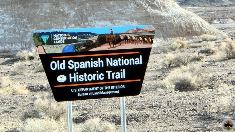
The Told Spanish Trail BLM Sign

The trail began as a network of routes used by Native American tribes, who traded goods such as salt, obsidian, and turquoise. In the late 18th century, Spanish traders began to use these routes to transport goods between Santa Fe and California. These traders were known as the “Comancheros” and were primarily focused on trading with the Ute and Navajo tribes in the area.

The route became known as the Old Spanish Trail in the early 19th century, when American traders began using the trail to transport furs and other goods to California. The trail was difficult to traverse, with harsh deserts, steep mountains, and treacherous canyons, but it was a vital link between the Southwest and the West Coast.

The trail was not a single route, but rather a network of different paths that crossed the desert and mountains of the Southwest. The most popular route followed the Virgin River in Utah, crossed the Colorado River at the mouth of the Virgin River, and then passed through the Mojave Desert to Los Angeles. Another route followed the Gila River in Arizona and crossed the Sonoran Desert to California.

The Old Spanish Trail played an important role in the development of the American West, as it provided a direct link between the remote and isolated communities of the Southwest and the growing cities of California. The trail was also a source of conflict, as American traders often clashed with Native American tribes over access to resources and trading rights.

In the mid-19th century, the discovery of gold in California brought thousands of settlers to the West Coast, and the Old Spanish Trail became a major thoroughfare for travelers and goods. The trail was also used by the Mormon pioneers, who traveled to California in the late 1840s and early 1850s.

In the late 19th century, the construction of railroads and highways made the Old Spanish Trail less important as a trade route. However, the trail remained an important part of the cultural history of the American Southwest, and efforts were made to preserve the trail and its landmarks.

Today, several sections of the Old Spanish Trail have been designated as National Historic Trails by the National Park Service, including sections in Utah, Colorado, New Mexico, and California. These trails allow visitors to experience the beauty and history of the Old Spanish Trail and to appreciate the legacy of the traders, Native Americans, and settlers who traveled its rugged terrain.

Old Spanish Trail Routes

All routes came together at Fork of Roads, east of present-day Barstow in the Mojave desert, and then crossed Cajon Pass between the San Gabriel and San Bernadino Mountains to Coastal California. After negotiating the pass, traders had an easy two to three days travel to the San Gabriel Mission and beyond to Los Angeles.

Armijo Route

Exterior, south facade of Mission San Gabriel Arcangel - 1878
Exterior, south facade of Mission San Gabriel Arcangel – 1878

The first complete trip across the trail began in Abiquiú, northwest of Santa Fe. The Armijo party followed well-known trails northwest to the San Juan River, then nearly due west to the Virgin River. They used the Crossing of the Fathers, cut into rock canyon wall some 75 years earlier by the Domínguez-Escalante party. Armijo’s caravan went down the Muddy River and across
the Mojave Desert to the Amargosa and Mojave Rivers, through Cajon Pass and down to Mission San Gabriel.

The Armijo and Northern Route diverge from each other on the east bound trail near the town of Tecopa, California.

Main Northern Route

First blazed by William Wolfskill and George C. Yount in 1831, this route veered northwest from Abiquiú through Southern Colorado and central Utah. It avoided the rugged canyons of the Colorado River that the Armijo party had encountered and took advantage of the better water and pasture resources across central Utah before returning to the Colorado River and Armijo’s route not far from Las Vegas.

Northern Branch

This route followed well-known trapper and trade routes north through the Rio Grande gorge to Taos and into southern Colorado. It then went west through Cochetopa Pass, largely open during the winter when other passes were snowed in and up the Gunnison River valley, rejoining the Northern Route near present-day Green River, Utah.

Mojave Road

Afton Canyon in the Mojave National Preserve.

The Mojave Road is a 188-mile crossing of the Mojave Desert long used by area Indians and by Spanish explorers and missionaries, it was first traveled by Jedediah Smith, an American trapper, in 1826.

Old Spanish Trail Locations

Government Holes in the central section of the Old Mojave Road.

Old Mojave Road

The Old Mojave Road (Government Road) is an east-west route that enters the Mojave National Preserve off the highway 95 in Nevada, and Afton Canyon…
The Told Spanish Trail BLM Sign

Old Spanish Trail

The Old Spanish Trail was a historic trade route that linked Santa Fe, New Mexico to Los Angeles, California. The trail was established in the…
Francisco Hermenegildo Tomás Garcés O.F.M. (April 12, 1738 – July 18, 1781)

Old Spanish Trail (Garces Expedition)

Old Spanish Trail (Garces Expedition) is a Nevada State Historic Marker Number 140 located in Clark County, Nevada. This marker is one of several which…
Captain John C. Frémont, explorer first mapped Diamond Valley Nevada

Old Spanish Trail (Journey of the Dead Man)

Old Spanish Trail (Journey of the Dead Man) is a Nevada State Historic Marker Number 139 located in Clark County, Nevada. This marker is one…

Old Spanish Trail Mountain Springs Pass – Nevada State Historic Marker

Old Spanish Trail Mountain Springs Pass is located along highway 160 and Nevada State Historic Marker No. 142 in Clark County, Nevada. The Old Spanish…
Old Tecopa house at smelter on Willow Creek, Amargosa Valley. Dr. Noble, Mrs. Noble. Inyo County, CA. 1922 - Photo from Herbert E. Gregory Book 8: 1915 - 1924.

Tecopa Inyo County

Tecopa is a small town located in the southeastern part of California, United States and its named for Chief Tecopa. The town is situated in…
The Old Spanish Trail 1829-1850 - Nevada State Historic Marker 33

The Old Spanish Trail 1829-1850 – Nevada State Historic Marker 33

Old Spanish Trail 1829-1850 is Nevada State Historic Marker Number 33, located in the town of Blue Diamond, in Clark County, Nevada. The Old Spanish…
Old Spanish Trail 1829-1850 - Nevada State Historic Marker #34 located in Mountain Springs, Nevada

The Old Spanish Trail 1829-1850 – Nevada State Historic Marker 34

Old Spanish Trail 1829-1850 is Nevada State Historic Marker Number 33, located in the town of Mountain Springs, in Clark County, Nevada. Old Spanish Trail…

References

George Benjamin Wittick – Photographer

George Benjamin Wittick was born in Pennsylvania and later moved to Illinois, and then out west in 1878 to pursue frontier photography. He served in the Civil War for the union using the name “Benjamin Wallace” in Company A of the 1st Minnesota Volunteer Cavalry and Company D of the 2nd Minnesota Volunteer Cavalry, from 1862 to 1865. He first worked for the Atlantic and Pacific Railroads before establishing his first photography studio in Gallup, New Mexico.

George Benjamin Wittick

During his career, he photographed many subjects to include the railroad; southwestern landscapes such as Canyon de Chelly, the Navajo Reservation, and Pueblo scenes; and the Native peoples mostly the Apache, Navajo, Hopi, and Zuni. Wittik was the first person to photograph the Hopi Snake Dance. An elder warned him at the time that he would die from a snake bite for witnessing the ceremony and not being an initiated member.

His photographs from this event brought the Hopi religious ritual great attention. 

George Benjamin Wittick - Self Portrait
George Benjamin Wittick – Self Portrait

He carried with him a collection of props for his photographs to include rifles, pistols, blankets, pottery, and more. Most of his photographs were taken outside using the natural sunlight against backdrops.

Geronimo (Goyathlay, 1820–1909), a Chiricahua Apache; full-length, kneeling with rifle, 1887 - Photograph George Benjamin Wittick
Geronimo (Goyathlay, 1820–1909), a Chiricahua Apache; full-length, kneeling with rifle, 1887 – Photograph George Benjamin Wittick

Billy The Kid

Easily, Wittick’s most famous photograph is of Henry McCarty, AKA Billy the Kidd, in Fort Sumner, New Mexico. The image is the only known image of the outlaw to be identified by those who knew him. The image It shows the outlaw dressed in a rumpled hat and ragged clothes, which include a bulky sweater. He’s is holding a Winchester carbine on his right side and a Colt revolver holstered on his left side. Two of these tintypes were produced. One is given to Paulita Maxwell, the kids girlfriend, and the other to friend Dan Dedrick. The last time this original is auctioned, it sold to William Koch for 2.3 million dollars.

Henry McCarty - AKA Billy the Kid - Fort Sumner, New Mexico, 1879 - 80 Tintype by George Benjamin Wittick
Henry McCarty – AKA Billy the Kid – Fort Sumner, New Mexico, 1879 – 80 Tintype by George Benjamin Wittick

It was taken by a traveling photographer who came through Fort Sumner [New Mexico] in 1880. Billy posed for it standing in the street near old Beaver Smith’s saloon. I never liked the picture. I don’t think it does Billy justice. It makes him look rough and uncouth. The expression of his face was really boyish and very pleasant. He may have worn such clothes as appear in the picture out on the range, but in Fort Sumner he was careful of his personal appearance and dressed neatly and in good taste.

Paulita Maxwell Jaramillo, the Kid’s girlfriend – 1920’s

In 1900, he established his last studio at Fort Wingate. In 1903. he decided to return to visit the Hopi Snake Dance. As a gesture of friendship towards the Hopu, he captured a rattlesnake to bring to as a gift. While handling the snake, he is bitten on the thumb on August 8, 1903 and died three weeks later at Fort Wingate, New Mexico, just as the Hopi elder had predicted many years earlier.

References

James Crysanthus Phelan – Rhyolite Shopkeeper

James Crysanthus Phelan

James Crysanthus Phelan was a business man and early pioneer of the desert southwest, who like many others followed the boom towns west. Early in his life, he owned a series of butcher shops in various towns throughout the south west, including Rhyolite. It is believed that his butcher shop was located on Golden Street across the street from the Cook Bank Building and near the Porter Brothers Store.

Biography

The automobile garage owned by James C. Phelan, and named after him, is cleverly planned, well built, and managed according to up-to-date methods. Mr. Phelan’s father, who was an honored veteran of the Union Army in our Civil War, is D. F. Phelan, and he is still living at Los Angeles.

Prior to casting his lot in the Golden State, he was a pioneer in Colorado. Mrs. Phelan, who was Annie Donahue before her marriage, is deceased. Born in the Centennial State on October 25, 1867, James C. Phelan was educated at the public schools in Colorado and New Mexico, and also, as he likes to put it, in ” the great school of experience.”

As a young man, he ventured in both the grocery and butcher business, having a store when only nineteen years of age, at Albuquerque, N. M. For fourteen years, too, his business at Williams, Arizona, was one of the most progressive and profitable establishments in that town. On September 9, 1893, Mr. Phelan was married to Miss Myrtie Dickinson, and this union was blessed with three boys and four girls, viz : Mary M., Chris E., Roy N., Jimmie J., Ruth E., Bernice L., and Leoma C, all of whom were educated in the public schools of Fresno, the two eldest studied at Heald’s Business College, while Roy N., is a student at the University of California at Berkeley.

Cook Bank Building, Rhyolite Nevada, Photo marked 1908 and "Courtesy of the Nevada Historical Society"
Cook Bank Building, Rhyolite Nevada, Photo marked 1908 and “Courtesy of the Nevada Historical Society”

Mr. Phelan has accepted the doctrines of the Christian Scientists, socially he finds recreation in the circles of the Woodmen of the World, the Knights of Pythias, and the Young Men’s Christian Association. In May, 1916, he built the finest and most complete auto establishment in California, spending $90,000 upon the same. He then became agent, for the San Joaquin Valley, of the Maxwell, Mitchell and Marmon automobiles, and the Kleiber and Maxwell Trucks. He employs from forty to fifty men to man the several departments, each of which is complete in itself.

When he first came to California, in 1905, he worked for three years on the Fresno ranch ; and then, getting into the automobile business in a modest way, he has made success after success. Mr. Phelan sold out in August. 1919. Mr. Phelan is a stanch Democrat, but always something more than a political partisan. In advocating and working for good roads, for example, his public-spiritedness has been particularly shown.

References

Raven ( Corvus corax )

The Raven ( Corvus corax ) is one of eight subspecies of Ravens distributed throughout the world. Also known as western or northern raven, this large black bird is a member of the Corvidae family of birds which also contains crows, jays and magpies. This bird is a rather large and features solid black feathers which offers a dramatic and ominous appearance.

Raven ( Corvus corax ) sitting on a coral fence at the Grand Canyon Western Ranch.

The raven is a large bird, known to average 25 inches in length and 2.6 pounds in weight and heaviest of the passerine or perching birds. This species is renowned for its intelligence and commonly used to test animal problem solving ability. This species has a world wide distribution and can thrive in a large variety of climates. The bird is an opportunistic omnivore finding sources of nutrition, feeding on carrion insects, grains, berries, fruit, small animals, other birds, and food waste. The are common features around campgrounds for the food sources left by human activity.

Range map of the Common Raven

The raven has a long history with man in culture, literature and superstition. Many Native American tribes cultures regard the bird as a trickster or a cosmic messenger. Edgar Allen Poe’s infamous poem forever linked this bird with ominous overtones and symbolism for in western culture. The National Football Team even has a football team named for this special mischievous bird.

Field Guide Description

“Large with a long, heavy bill and long wedge-shaped tail. Most common call is a low drawn-out croak. Larger than the Chihuahuan Raven; note thicker, shaggier throat feathers, and that nasal bristles to not extend as far our on the larger bill. Range: Found in a variety of habitats, including mountains, deserts, coastal areas. Numerous in western and northern part of range; uncommon and local, but spreading in Appalachians.”

Field Guide to the Birds of North America, Third Edition, pg 318

Classification

KingdomAnimalia
PhylumChordata
ClassAves
OrderPasseriformes
FamilyCorvidae
Genus Corvus
Speciescorax

References