Christopher Houston Carson

Christopher Houston Carson (December 24, 1809 â€“ May 23, 1868), also known as “Kit” Carson, was a nineteenth century American Frontiersman, Army Officer and Politician and the namesake of Carson City, Nevada. During his lifetime, he achieved notoriety for his exploits as an Indian Fighter, Fur Tapper, Mountain man

Christopher 'Kit' Carson (1809-1868), American explorer - Photograph byMathew Brady or Levin C. Handy - This image is available from the United States Library of Congress's Prints and Photographs division under the digital ID cwpbh.00514.
Christopher ‘Kit’ Carson (1809-1868), American explorer – Photograph by Mathew Brady or Levin C. Handy – This image is available from the United States Library of Congress’s Prints and Photographs division.

Carson was born on December 24, 1809 in Madison County, Kentucky to Lindsey Carson and Rebecca Robinson Carson. He is a cousin to Danial Boone on his mothers’ side. The family moved to Missouri two years later. Survival being the priority, Carson never learned to read or write. At the age of 16, he signed up with a large caravan of merchants headed west towards Santa Fe.

Exploration

In 1854, a change encounter with the explorer John C. Frémont, made Carson an active participant in the clash of empires that eventually extended the boundaries of the continental United States to its present. The two men met aboard a steamboat on the Missouri River. He served as a guide to for Fremont on three expeditions for a sum of $100 per month. These expeditions found the Oregon Trail and opened to west for the settlers who followed.

First expedition, 1842

In 1842, during the first expedition, Carson guided Frémont across the Oregon Trail to South Pass, Wyoming. The purpose of this expedition was to map and describe the Oregon Trail as far as South Pass. It is during this trip, that the two men produced a guidebook, maps, and other paraphernalia would be printed for westward-bound migrants and settlers. After the completion of the five-month expedition, Frémont wrote his government reports, which made Carson’s name known across the United States, and spurred a migration of settlers westward to Oregon via the Oregon Trail.

Second expedition, 1843

In 1843, Carson agreed to join Frémont’s again during his second expedition into the west. Carson guided Frémont across part of the Oregon Trail to the Columbia River in Oregon. The purpose of the expedition was to map and describe the Oregon Trail from South Pass, Wyoming, to the Columbia River. They also ventrured towards the Great Salt Lake in Utah, using a rubber raft to navigate the waters.

On the way to California, the party is held up during bad weather in the Sierra Nevada Mountains. Fortunately, Carson’s good judgement and his skills as a guide and they found some American settlers who fed them. The expedition turned towards California. This ventures is illegal, at the time, and dangerous because California was Mexican territory.

During the expedition, the expedition arrive in the Mojave Desert. His party met a Mexican man and boy, who informed Carson that Native Americans had ambushed their party. The Native Americans killed the men, and the women are staked to the ground, sexually mutilated, and killed. The murderers then stole the Mexicans’ 30 horses. Carson and a mountain man friend, Alexis Godey, went after the murderers. It took the two men, two days to find the culprits. The pair rushed into their camp and killed and scalped two of the murderers. The horses were recovered and returned to the Mexican man and boy. This act brought Carson even greater reputation and confirmed his status as a western hero in the eyes of the American people.

The Mexican government ordered Frémont to leave. Frémont returned to Washington, DC and filed his reports. He but did not mention the California trip. The government liked his reports but ignored his illegal trip into Mexico. Frémont was made a captain. The newspapers nicknamed Fremont, “The Pathfinder.”

Third expedition, 1845

In 1845, Carson lead Frémont on a third expedition. Leaving Westport Landing, Missouri, they crossed the Rockies, passed the Great Salt Lake, and down the Humboldt River to the Sierra Nevada of California and Oregon. The third expedition is more political in nature. Frémont may have been working under secret government orders. US President Polk wanted Alta California, which includes parts of California, Arizona, Nevada, Utah and parts of Wyoming.

Once in California, Frémont set out to rouse American settlers into a patriotic fervor. The Mexican General Jose Castro at Monterey ordered him to leave. On Gavilan Mountain, Frémont erected a makeshift fort and raised the American Flag in defiance to these orders. While in Oregon, while camped near Klamath Lake, a messenger from Washington, DC, caught up with Fremont and made it clear that Polk wanted California.

On 30 March 1846, while traveling north along the Sacramento Valley, Fremont’s expedition met a group of Americans Settlers. The settlers claimed that a band of Native Americans was planning to attack them. Frémont’s party set about searching for Native Americans. On April 5 1846, Frémont’s party spotted a Wintu village and launched a vicious attack, which resulted in the deaths of approximately 120 to 300 men, women, and children and the displacement of many more. This act of savagery became known as the Sacramento River massacre. Carson, later stated that “It was a perfect butchery.

Army

Kit Carson accepted a commission as a colonel in the U.S. Army in 1861, Carson fought against Native American and Confederate forces in several actions.

His fame was then at its height,… and I was very anxious to see a man who had achieved such feats of daring among the wild animals of the Rocky Mountains, and still wilder Indians of the plains…. I cannot express my surprise at beholding such a small, stoop-shouldered man, with reddish hair, freckled face, soft blue eyes, and nothing to indicate extraordinary courage or daring. He spoke but little and answered questions in monosyllables.

Northern Civil War General William Tecumseh Sherman
References

Old Spanish Trail

The Old Spanish Trail was a historic trade route that linked Santa Fe, New Mexico to Los Angeles, California. The trail was established in the early 19th century and was primarily used for the transportation of goods, such as furs, horses, and mules.

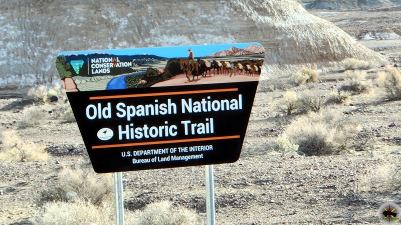
The Told Spanish Trail BLM Sign

The trail began as a network of routes used by Native American tribes, who traded goods such as salt, obsidian, and turquoise. In the late 18th century, Spanish traders began to use these routes to transport goods between Santa Fe and California. These traders were known as the “Comancheros” and were primarily focused on trading with the Ute and Navajo tribes in the area.

The route became known as the Old Spanish Trail in the early 19th century, when American traders began using the trail to transport furs and other goods to California. The trail was difficult to traverse, with harsh deserts, steep mountains, and treacherous canyons, but it was a vital link between the Southwest and the West Coast.

The trail was not a single route, but rather a network of different paths that crossed the desert and mountains of the Southwest. The most popular route followed the Virgin River in Utah, crossed the Colorado River at the mouth of the Virgin River, and then passed through the Mojave Desert to Los Angeles. Another route followed the Gila River in Arizona and crossed the Sonoran Desert to California.

The Old Spanish Trail played an important role in the development of the American West, as it provided a direct link between the remote and isolated communities of the Southwest and the growing cities of California. The trail was also a source of conflict, as American traders often clashed with Native American tribes over access to resources and trading rights.

In the mid-19th century, the discovery of gold in California brought thousands of settlers to the West Coast, and the Old Spanish Trail became a major thoroughfare for travelers and goods. The trail was also used by the Mormon pioneers, who traveled to California in the late 1840s and early 1850s.

In the late 19th century, the construction of railroads and highways made the Old Spanish Trail less important as a trade route. However, the trail remained an important part of the cultural history of the American Southwest, and efforts were made to preserve the trail and its landmarks.

Today, several sections of the Old Spanish Trail have been designated as National Historic Trails by the National Park Service, including sections in Utah, Colorado, New Mexico, and California. These trails allow visitors to experience the beauty and history of the Old Spanish Trail and to appreciate the legacy of the traders, Native Americans, and settlers who traveled its rugged terrain.

Old Spanish Trail Routes

All routes came together at Fork of Roads, east of present-day Barstow in the Mojave desert, and then crossed Cajon Pass between the San Gabriel and San Bernadino Mountains to Coastal California. After negotiating the pass, traders had an easy two to three days travel to the San Gabriel Mission and beyond to Los Angeles.

Armijo Route

Exterior, south facade of Mission San Gabriel Arcangel - 1878
Exterior, south facade of Mission San Gabriel Arcangel – 1878

The first complete trip across the trail began in Abiquiú, northwest of Santa Fe. The Armijo party followed well-known trails northwest to the San Juan River, then nearly due west to the Virgin River. They used the Crossing of the Fathers, cut into rock canyon wall some 75 years earlier by the Domínguez-Escalante party. Armijo’s caravan went down the Muddy River and across
the Mojave Desert to the Amargosa and Mojave Rivers, through Cajon Pass and down to Mission San Gabriel.

The Armijo and Northern Route diverge from each other on the east bound trail near the town of Tecopa, California.

Main Northern Route

First blazed by William Wolfskill and George C. Yount in 1831, this route veered northwest from Abiquiú through Southern Colorado and central Utah. It avoided the rugged canyons of the Colorado River that the Armijo party had encountered and took advantage of the better water and pasture resources across central Utah before returning to the Colorado River and Armijo’s route not far from Las Vegas.

Northern Branch

This route followed well-known trapper and trade routes north through the Rio Grande gorge to Taos and into southern Colorado. It then went west through Cochetopa Pass, largely open during the winter when other passes were snowed in and up the Gunnison River valley, rejoining the Northern Route near present-day Green River, Utah.

Mojave Road

Afton Canyon in the Mojave National Preserve.

The Mojave Road is a 188-mile crossing of the Mojave Desert long used by area Indians and by Spanish explorers and missionaries, it was first traveled by Jedediah Smith, an American trapper, in 1826.

Old Spanish Trail Locations

Government Holes in the central section of the Old Mojave Road.

Old Mojave Road

The Old Mojave Road (Government Road) is an east-west route that enters the Mojave National Preserve off the highway 95 in Nevada, and Afton Canyon…
The Told Spanish Trail BLM Sign

Old Spanish Trail

The Old Spanish Trail was a historic trade route that linked Santa Fe, New Mexico to Los Angeles, California. The trail was established in the…
Francisco Hermenegildo Tomás Garcés O.F.M. (April 12, 1738 – July 18, 1781)

Old Spanish Trail (Garces Expedition)

Old Spanish Trail (Garces Expedition) is a Nevada State Historic Marker Number 140 located in Clark County, Nevada. This marker is one of several which…
Captain John C. Frémont, explorer first mapped Diamond Valley Nevada

Old Spanish Trail (Journey of the Dead Man)

Old Spanish Trail (Journey of the Dead Man) is a Nevada State Historic Marker Number 139 located in Clark County, Nevada. This marker is one…

Old Spanish Trail Mountain Springs Pass – Nevada State Historic Marker

Old Spanish Trail Mountain Springs Pass is located along highway 160 and Nevada State Historic Marker No. 142 in Clark County, Nevada. The Old Spanish…
Old Tecopa house at smelter on Willow Creek, Amargosa Valley. Dr. Noble, Mrs. Noble. Inyo County, CA. 1922 - Photo from Herbert E. Gregory Book 8: 1915 - 1924.

Tecopa Inyo County

Tecopa is a small town located in the southeastern part of California, United States and its named for Chief Tecopa. The town is situated in…
The Old Spanish Trail 1829-1850 - Nevada State Historic Marker 33

The Old Spanish Trail 1829-1850 – Nevada State Historic Marker 33

Old Spanish Trail 1829-1850 is Nevada State Historic Marker Number 33, located in the town of Blue Diamond, in Clark County, Nevada. The Old Spanish…
Old Spanish Trail 1829-1850 - Nevada State Historic Marker #34 located in Mountain Springs, Nevada

The Old Spanish Trail 1829-1850 – Nevada State Historic Marker 34

Old Spanish Trail 1829-1850 is Nevada State Historic Marker Number 33, located in the town of Mountain Springs, in Clark County, Nevada. Old Spanish Trail…

References

Lava Point Campground

Lava Point Campground is a remote, backcountry campground located in the Kolob Terrace area of Zion National Park in Utah. Situated at an elevation of 7,890 feet, the campground offers stunning views of the surrounding landscape, including the Zion Canyon and the Pine Valley Mountains.

Location and Access Lava Point Campground is located in the northwest section of Zion National Park, approximately 25 miles from the main entrance. To access the campground, visitors must take the Kolob Terrace Road, a scenic, winding road that climbs more than 2,000 feet in elevation over the course of 10 miles. The road is narrow and steep in places, and visitors should be prepared for challenging driving conditions.

Once at the campground, visitors will find 6 campsites, each with a picnic table and fire ring. There are no RV hookups, and generators are not allowed. The campground is open from May through October, weather permitting. Reservations are required and can be made up to six months in advance.

Amenities Lava Point Campground is a primitive campground, meaning there are no showers, running water, or flush toilets. Visitors must bring their own water or obtain it from a nearby water source, such as the North Creek or the nearby Lava Point Spring. Visitors must also pack out their trash and follow Leave No Trace principles.

Despite the lack of amenities, Lava Point Campground offers a unique camping experience for those seeking a backcountry adventure. The campground is situated in a ponderosa pine forest and offers stunning views of the surrounding landscape. Visitors can relax in a peaceful, secluded environment and enjoy the quiet of nature.

Activities The Lava Point area of Zion National Park offers a wide range of activities for visitors to enjoy. Hiking is a popular activity, and visitors can access a number of trails from the campground, including the West Rim Trail, which offers stunning views of the Zion Canyon and the surrounding mountains.

The Kolob Reservoir is also located nearby, offering opportunities for fishing, boating, and swimming. The reservoir is stocked with rainbow trout, and visitors can rent boats from nearby outfitters.

Visitors can also explore the nearby North Creek, which runs through a narrow slot canyon and offers a challenging and rewarding hiking experience. The creek is known for its crystal-clear water and stunning rock formations.

Finally, the Lava Point area offers some of the best stargazing opportunities in the park. The campground is situated far from the light pollution of nearby cities, and visitors can enjoy a clear view of the stars on a clear night.

Tips for Visitors Visitors to Lava Point Campground should be prepared for the remote, backcountry experience. The campground is located at a high elevation, and temperatures can drop significantly at night, even during the summer months. Visitors should bring warm clothing and be prepared for cold and windy conditions.

Because of the campground’s remote location, visitors should also bring all the food and supplies they will need for their stay. There are no stores or restaurants nearby, and the nearest town is more than an hour’s drive away.

Visitors should also be prepared for challenging driving conditions on the Kolob Terrace Road. The road is narrow and steep in places, and visitors should take their time and drive cautiously.

Finally, visitors should remember to follow Leave No Trace principles and pack out all trash and waste. The remote location of the campground means that visitors must be responsible for their own impact on the environment.

Conclusion Lava Point Campground offers a unique and rewarding camping experience for those seeking a backcountry adventure in Zion National Park. The campground’s remote location and lack of amenities

South Campground

South Campground is one of the most popular campgrounds in Zion National Park, located in Springdale, Utah. It is situated at an elevation of 3,900 feet, surrounded by the towering cliffs of Zion Canyon and offering access to some of the park’s most iconic hikes and attractions.

South Campground, Zion National Park, Utah, Medium Format Photograph: James L Rathbun
Temple of Sinawava, Zion National Park, Utah, Medium Format Photograph: James L Rathbun

Amenities and Facilities:

South Campground offers a range of amenities and facilities to make your camping experience as comfortable and enjoyable as possible. Some of the key amenities include:

  1. Campsites: South Campground offers a total of 127 campsites, including 13 group sites and 4 accessible sites. The campsites are arranged in loops, with each loop offering its own set of amenities and facilities.
  2. Restrooms: There are two sets of restrooms located within South Campground, each with running water and flush toilets. The restrooms are cleaned daily and are equipped with hand dryers and baby changing stations.
  3. Picnic tables and fire pits: Each campsite at South Campground comes with a picnic table and a fire pit, allowing campers to enjoy meals and roast marshmallows over a campfire.
  4. Water: There are several water spigots located throughout, allowing campers to fill up their water bottles and clean their dishes.
  5. Dump station: There is a dump station located near the entrance, allowing campers to dispose of their waste.
  6. Camp store: There is a camp store located near the entrance, offering a range of supplies and souvenirs for campers.

Features:

South Campground is known for its stunning natural beauty and its proximity to some of Zion National Park’s most iconic features. Here are some of the key features of South Campground:

  1. Zion Canyon: South Campground is located in Zion Canyon, which is known for its towering cliffs, narrow canyons, and stunning vistas. The canyon can be accessed via the Zion Canyon Scenic Drive, which is closed to private vehicles from April to October.
  2. Hiking trails: South Campground offers access to a range of hiking trails, including the famous Angels Landing and The Narrows hikes. Angels Landing is a strenuous hike that involves a steep ascent up a narrow ridge to a scenic overlook, while The Narrows is a water hike that takes you through the narrowest section of Zion Canyon.
  3. Wildlife: The area is home to a range of wildlife, including mule deer, coyotes, and a variety of birds. Visitors are advised to keep a safe distance from wildlife and to store food and other items in bear-proof containers.
  4. Dark skies: Zion National Park is known for its dark skies, making it an ideal location for stargazing. Visitors can enjoy views of the Milky Way and other celestial objects on clear nights.

Reservations

South Campground is a popular destination, and reservations are strongly recommended, especially during peak season (March to November). Reservations can be made up to six months in advance through the National Park Service website or by calling the reservation line. There are no walk-in sites available and campers are required to have a reservation before arriving.

Campground Map

References

Watchman Campground

Watchman Campground is located in Zion National Park in southwestern Utah and offers visitors the opportunity to experience the beauty of Zion up close while also enjoying the convenience of modern amenities.

History:

Watchman Campground was established in the 1960s and was named after the Watchman rock formation that rises above the campground. The campground was designed to provide a comfortable and convenient base for visitors to explore the park, while also preserving the natural beauty of the area.

Amenities:

Watchman Campground offers a variety of amenities to make visitors’ stay comfortable and enjoyable. These include:

  • Campsites: The campground offers a total of 176 campsites, including 95 RV sites and 81 tent sites. All sites are equipped with a picnic table and fire pit or grill, and most sites have electric hookups.
  • Restrooms: The campground has three modern restroom facilities with flush toilets and sinks, as well as several water filling stations.
  • Dump station: There is a dump station located at the entrance to the campground for RVs to use.
  • Laundry facilities: The campground has a coin-operated laundry facility available for guests to use.
  • Camp store: The Watchman Campground store offers a variety of camping supplies, snacks, souvenirs, and other items.

Activities:

There are numerous activities available to visitors at Watchman Campground and the surrounding area. Some of these include:

  • Hiking: There are numerous hiking trails in Zion National Park that are easily accessible from the campground, including the Watchman Trail, which offers stunning views of the surrounding area.
  • Biking: Biking is allowed on the Pa’rus Trail, which is accessible from the campground and offers a scenic route through the park.
  • Rock climbing: Zion National Park is a popular destination for rock climbers, and there are numerous climbing routes available throughout the park.
  • Wildlife viewing: Zion is home to a variety of wildlife, including bighorn sheep, mule deer, and numerous bird species. Visitors can often see these animals while hiking or exploring the park.
  • Ranger programs: The park offers a variety of ranger-led programs, including guided hikes, campfire talks, and stargazing events.

Reservations

Reservations for Watchman Campground can be made online or by phone up to six months in advance. The campground is open year-round, although some sites may be closed during the winter months due to snow. During peak season (March through November), reservations are highly recommended, as the campground often fills up quickly.

Fees

The nightly fee for a campsite at Watchman Campground varies depending on the season and type of site. Tent sites are generally less expensive than RV sites, and fees are higher during peak season. In addition to the nightly fee, visitors to Zion National Park are required to pay an entrance fee. The fee varies depending on the type of vehicle and the length of stay.

Recreation.gov

Accessibility

Watchman Campground is accessible to visitors with disabilities, with several ADA-accessible campsites and restrooms available. The Pa’rus Trail, which is accessible from the campground, is also ADA-accessible.

Conclusion

Watchman Campground is a popular destination for visitors to Zion National Park, offering modern amenities and convenient access to the park’s many activities and attractions. With its stunning scenery, numerous hiking trails, and abundant wildlife, Zion is a must-see destination for anyone interested in exploring the beauty of the American Southwest. Whether you’re camping in a tent or RV, Watchman Campground provides the perfect base for your Zion adventure.

Campground Map